Rising sea levels and more frequent and severe storms threaten coastal regions worldwide, causing flooding and eroding coastlines. It is essential to research and understand these storm events to be able to predict their impact on barrier island and coastal communities and consequently take appropriate protection and mitigation measures.
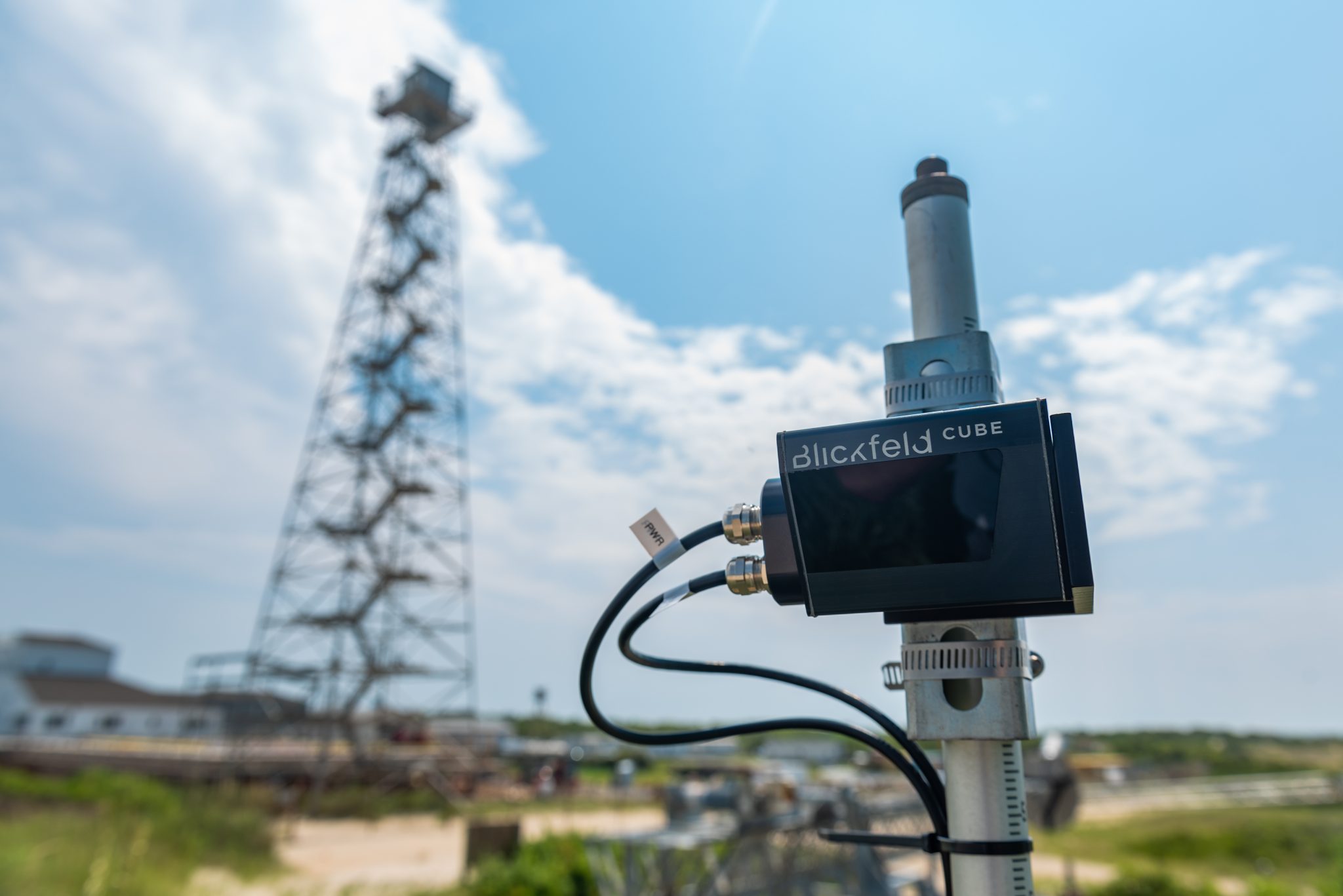
A team at the University of North Carolina Wilmington (UNCW) led by Dr. Ryan Mieras is conducting intensive research in this area using the Blickfeld Cube 1 LiDAR sensors. Their goal is to develop a measuring system that can be rapidly installed at beaches to remotely measure water levels, waves, and the evolution of the beach profile during a storm event.
As part of DUNEX (DUring Nearshore EXperiment), a multi-agency, academic, and Non-Governmental Organization (NGO) collaborative community, Dr. Mieras deployed the Blickfeld Cube 1 LiDAR sensor for two weeks in early August 2021, collecting data on changes in the beach profile, waves, and water levels at the U.S. Army Corps of Engineers’ (USACE) Coastal Hydraulics Laboratory (CHL), Field Research Facility (FRF) in Duck, North Carolina, USA. The requirements are multifaceted, recording both shoreline changes that take place over a longer period of time and larger spatial dimensions, as well as wave profiles that require fast and continuous data acquisition in a much narrower spatial field.
“We are currently testing how the configurable scan patterns of the Blickfeld sensors can best be used for these different requirements,” reports Dr. Mieras. “The great flexibility in the configuration and mounting of the sensors is a big advantage, and the data look very promising.”
In addition to the flexible scan pattern configurations, the Blickfeld Cube 1 sensor also provides the robustness needed to reliably capture 3D data on the coast. Compared to cameras, LiDAR data offers an additional dimension and is not affected by difficult lighting conditions or darkness. They therefore represent a valuable asset to coastal remote measurement systems.
“The goal is to develop affordable and scalable remote sensing platforms to measure storm surge impact on coastal areas,” says Mieras. “The human and operational resources and support that DUNEX provides, coupled with the expertise of the researchers, are the perfect framework to push the development and research forward.”
Beyond DUNEX, Mieras will continue his partnership with researchers from the U.S. Army Corps of Engineers. Mieras says their next steps involve “synthesizing the data collected during the pilot campaign in August 2021, followed by development of algorithms that will filter the data and detect things like how far each wave traverses up the beach, and how much the beach elevation changes over time.”
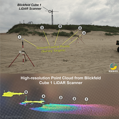
a wave depicted in a point cloud.
Credit for header image: UNCW