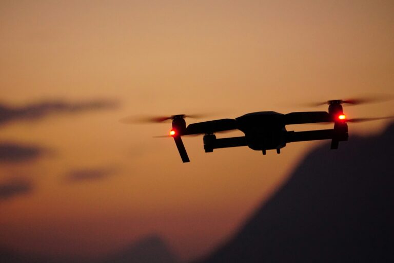

As technology advances, the unequivocal utility of drones in many different areas becomes self-evident. The applications are endless, from hobbyists using drones for photography to the state-of-the-art drones for surveillance of high-security premises. One such application that has become increasingly interesting in recent years is drones for delivery in the freight and logistics sector.
One of the most significant barriers to adopting drones for delivery is the technical problem of ensuring error-free navigation and maneuvering in an urban environment. This problem can be remedied by using fit-for-purpose sensors, such as LiDARs. The use of drones with LiDAR would accelerate the adoption of the technology in the delivery application, courtesy of LiDAR’s cm-level precision and real-time 3D mapping of the surroundings.
Current challenges for the logistics industry
Companies scramble to meet the previously unthinkable number of shipments in the modern world of same-day delivery and astonishingly shortened supply chains. For instance, during the holiday season of 2020, Amazon delivered a whopping 1.5 billion packages across the globe. Businesses are racing to adopt new technologies and try experimental supply chain models to increase delivery volumes, expedite deliveries, and satisfy customers while cutting costs to remain competitive.
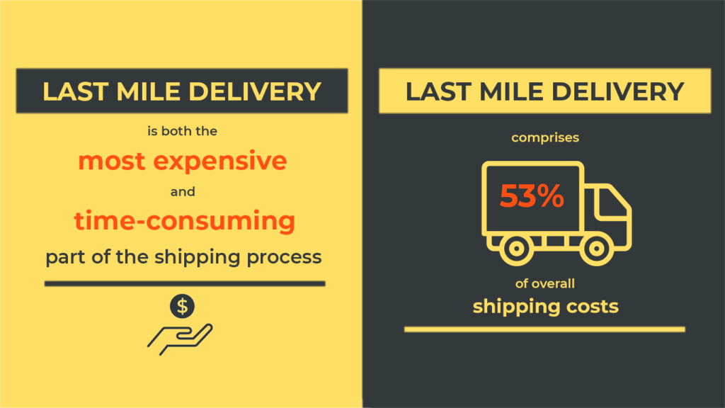
But the most significant pain point in any supply chain is often pinned at the last part of the process, known as the Last Mile Delivery.
What is Last-Mile Delivery?
Last-Mile Delivery logistics connect regional distribution centers, such as warehouses or “transportation hubs,” to the final destination. Therefore, it is no surprise that last-mile delivery accounts for up to 53% of shipping costs globally. A significant chunk of that includes the labor costs, and the phenomenon is worsened in rural areas where the sparse population exacerbates delivery inefficiencies.
How Drones can help solve challenges for the logistics industry
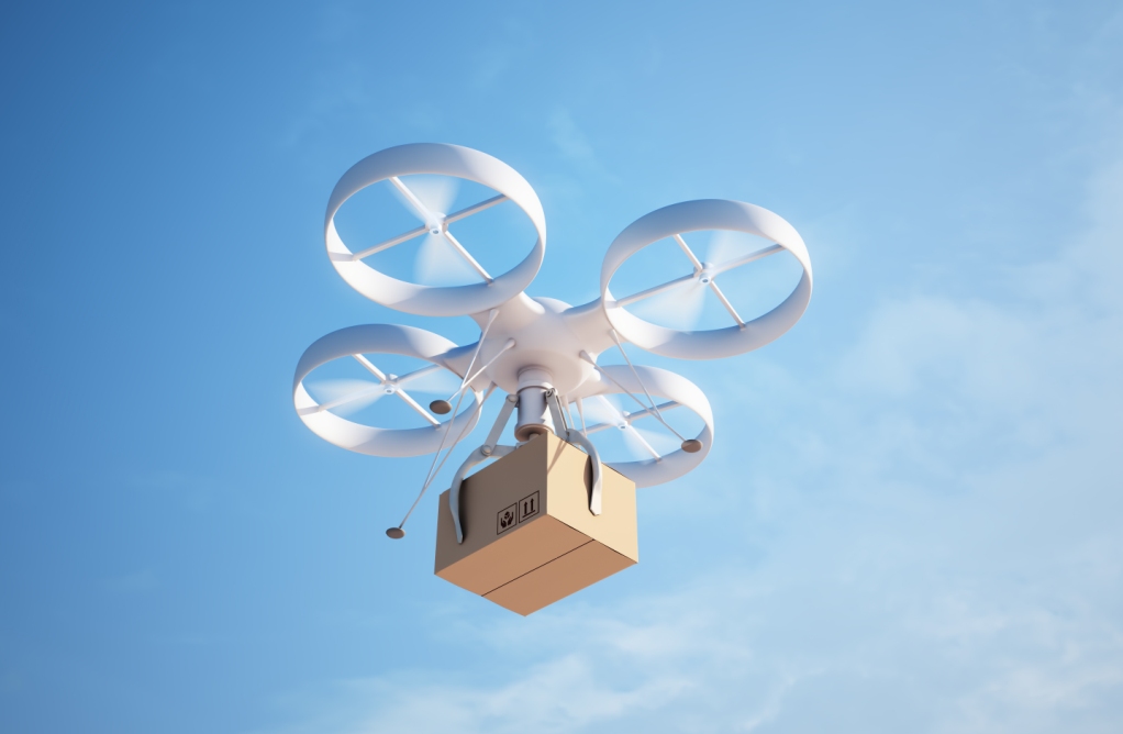
Using a drone for Last-Mile Delivery can lead to a considerable reduction in costs. For instance, a 2016 study indicated that in comparison to a U.S. postage company delivery van in a mid-sized U.S. city, Amazon Prime’s drone delivery scheme could cut costs by one-third on the busiest days of the year, primarily due to minimum reliance on manual labor.
Similarly, UPS has been mulling over installing mini-helipads on their delivery trucks. According to estimates, they could save up to $50 million by eliminating just one mile from the routes of each of their 66,000 delivery trucks. Unlike delivery trucks, drones utilize the untapped low-altitude airspace, allowing them to avoid traffic. These shorter delivery times would reduce shipping costs for customers and lead to profitability and sales boost for businesses.
Where are Delivery Drones currently being used?
Since Amazon’s drone delivery program started in 2018, the company has gone through multiple delivery-drone designs and thousands of drone training hours. It has also received the Federal Aviation Administration’s permission to conduct drone operations in 2020.
Also, Google’s parent company, Alphabet, has launched its version of the futuristic delivery service in Logan, Australia. Through their subsidiary company called Wing, suburban drone deliveries have become a reality.
What sensors are required for making delivery drones a reality?
To utilize the enormous potential that delivery drones offer, they need to be able to fly autonomously and safely using dependable environmental sensing. There are three primary methods for environmental sensing that can be used for object detection and avoidance. The most common one is optical sensing, such as cameras. Although these cameras are very small, they offer limited visible distance, cannot detect all objects, and require sizable hardware and power sources to operate.
The second option is radar, reflecting radio waves off objects to navigate. Radar offers long detection ranges, sometimes even up to 1 km. But it is also ridden by many limiting factors, such as low sensing precision due to wide signal beam divergence. It means that a radar-based drone can detect that there is “something” out there but cannot decipher what exactly it is. And again, it also requires a large system size and onboard power to function.
Where do the drones with LiDAR sensors come into play?
As seen above, considerable technological hurdles must be resolved before drones can autonomously take over Last-Mile Delivery. This is where LiDAR comes in, which calculates the distance from objects by emitting short laser pulses and recording the time it takes to rebound off objects. The result is a rich set of data used to generate high-resolution maps and 3D models of natural and man-made objects and surroundings, including roads, buildings, and natural landscape features.
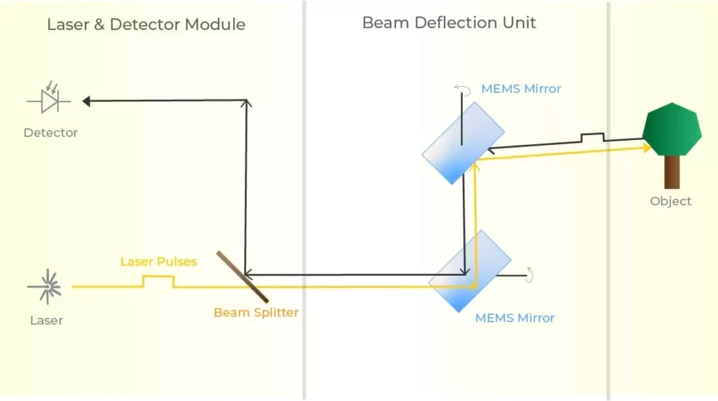
LiDARs offer higher resolution than other sensors and generate a denser point cloud, meaning the received information is more robust. Therefore, it gives more flexibility to run a range of algorithms and analyses. LiDARs also allow cm-level precision and a large field-of-view, enabling delivery drones to achieve challenging tasks like altitude hold, obstacle avoidance, and landing area clearance.
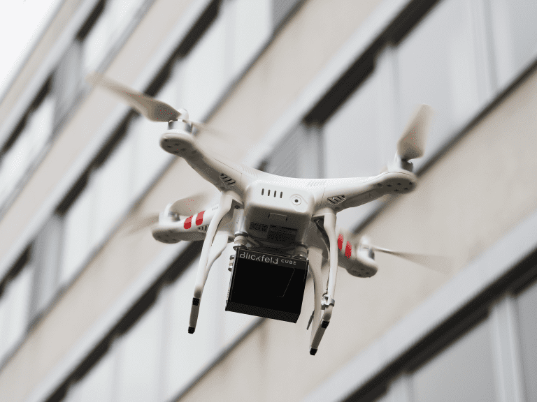
Any sensor that can be successfully integrated into a drone needs a low-power, lightweight, and small volume ranging module. Blickfeld’s Cube 1 stands out in this area with extremely small dimensions for a LiDAR sensor. This way, it can match the needed parameters, ensuring that maximum payload weight can be transported for longer distances with minimum battery consumption.
Another must-have feature of sensors that are integrated into drones is their ruggedness. They need to deliver detailed and reliable data even under mechanical vibration and weather conditions such as rain or fog. Blickfeld LiDARs are high performing in this area as well: Their solid-state design allows them to remain unaffected by vibration or challenging lighting and weather conditions. LiDAR sensors, in general, are also light-independent, meaning can operate even at night without any ambient light with the same accuracy and dependability – a key pain point for cameras.

Legal restrictions for delivery drones – LiDAR again comes to the rescue
Besides the technological hurdles, the single biggest obstacle for delivery drones is how most countries have suffocating laws that restrict the flight of commercial drones in certain areas. Current airspace restrictions mean that most air routes are entirely off-limits to drones.
This mistrust emanates from privacy concerns about how a drone can hover over your house and sneakily record your activities without your consent or knowledge. Drones with LiDAR offer a unique solution concerning other traditionally used sensors, such as cameras. They record anonymous 3D data during its operations, which means that the identities, and therefore the privacy of people, is never compromised while enabling the drone to seamlessly navigate to its destination.
Environmental benefits of adopting drones with LiDAR for urban freight logistics
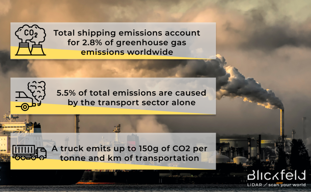
Besides the cost-cutting for businesses, delivery drones with LiDAR could also significantly reduce air pollution. Cities currently contribute up to 70% of the world’s total greenhouse gas emissions, with 5.5% of total emissions caused by the transport sector alone. The dependence of businesses and logistics companies on large fleets for meeting the ever-increasing demand aggravates the already overstressed road infrastructure.
It contributes significantly to traffic congestion and, therefore, carbon emissions. For instance, the average package delivery via a truck alone creates about 1kg of greenhouse gas emissions. The logistics sector needs to adopt policies that go beyond just using electric vehicles and look for disruptive innovations to reduce their carbon footprint. Utilizing the low-altitude airspace via delivery drones will reduce the threat of further congestion and relieve the pressure on urban infrastructure.
Delivery Drones with LiDAR are the Future of Logistics
McKinsey estimates that autonomous vehicles, which include self-flying drones, will deliver 80% of all items in the future. And the commercial UAV (Unmanned Aerial Vehicle) market was valued at over $22 billion in 2021! Drones are far from maturity, but ignoring their utility in business operations and long-term strategy would potentially leave companies in the dust of their competitors.
Drones with LiDAR offer a real opportunity to revolutionize supply chains and improve customer satisfaction while alleviating pressure on the traditional road network used for last-mile logistics and will also provide immense environmental benefits.