
What is LiDAR?
LiDAR is a popular remote sensing method that employs light in the form of a pulsed laser to detect and categorize objects. LiDAR sensors generate precise, 3-dimensional information about the shape of surrounding objects and their surface characteristics. The technology uses laser beams within the eye-safe range to create a 3D representation of the surveyed environment.
Typical applications of LiDAR sensor comprise surveying, geography, atmospheric physics, and archeology, but today it is used in many state-of-the-art applications as well as robotics, smart cities, and autonomous vehicles.
What is the definition of LiDAR?
LiDAR is an acronym of Light Detection and Ranging. It is also known as laser scanning or 3D scanning.
Key components of a LiDAR Sensor
A LiDAR sensor primarily includes:
- Laser Source: Emits laser pulses.
- Scanner: Deflects light across the scene.
- Detector: Collects the reflected light.
Additional components, such as optical lenses, support the overall functionality.
How does LiDAR technology work?
LiDAR typically operates using the time-of-flight principle, where it emits pulsed light waves into the environment. These pulses bounce off objects and return to the sensor’s detector, and the time taken for the light to return is used to calculate distances. There are also other modes, like FMCW, which we discuss in detail in this blog post.
The diagrams below succinctly explains the time of flight principle:
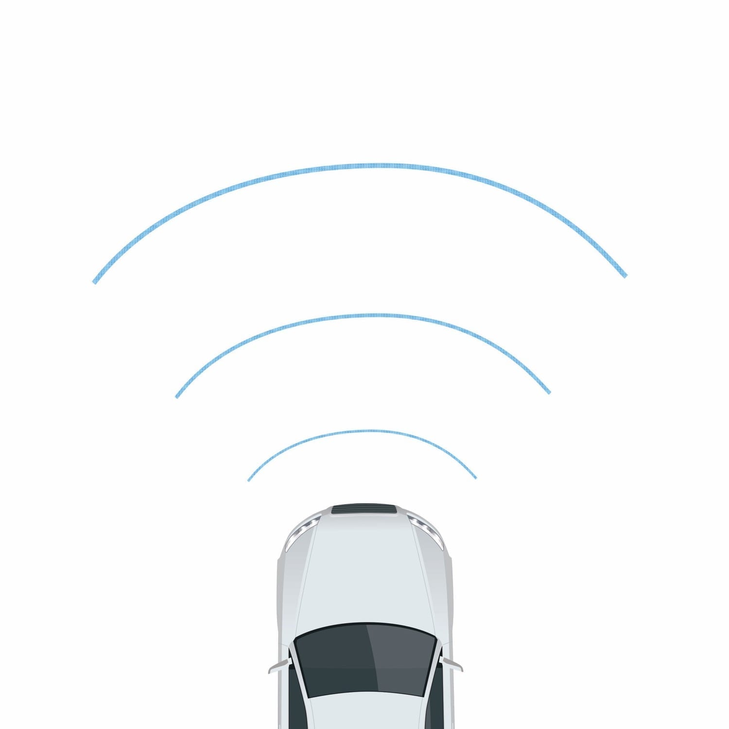
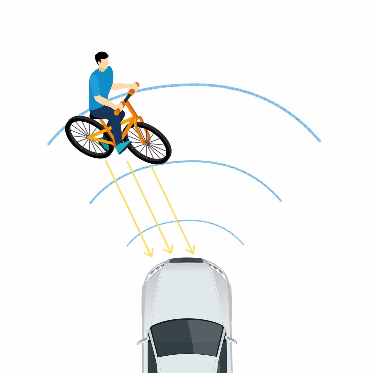
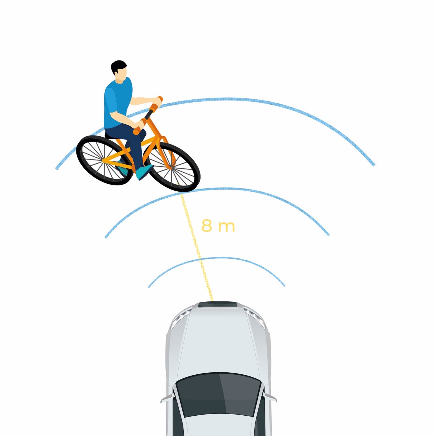
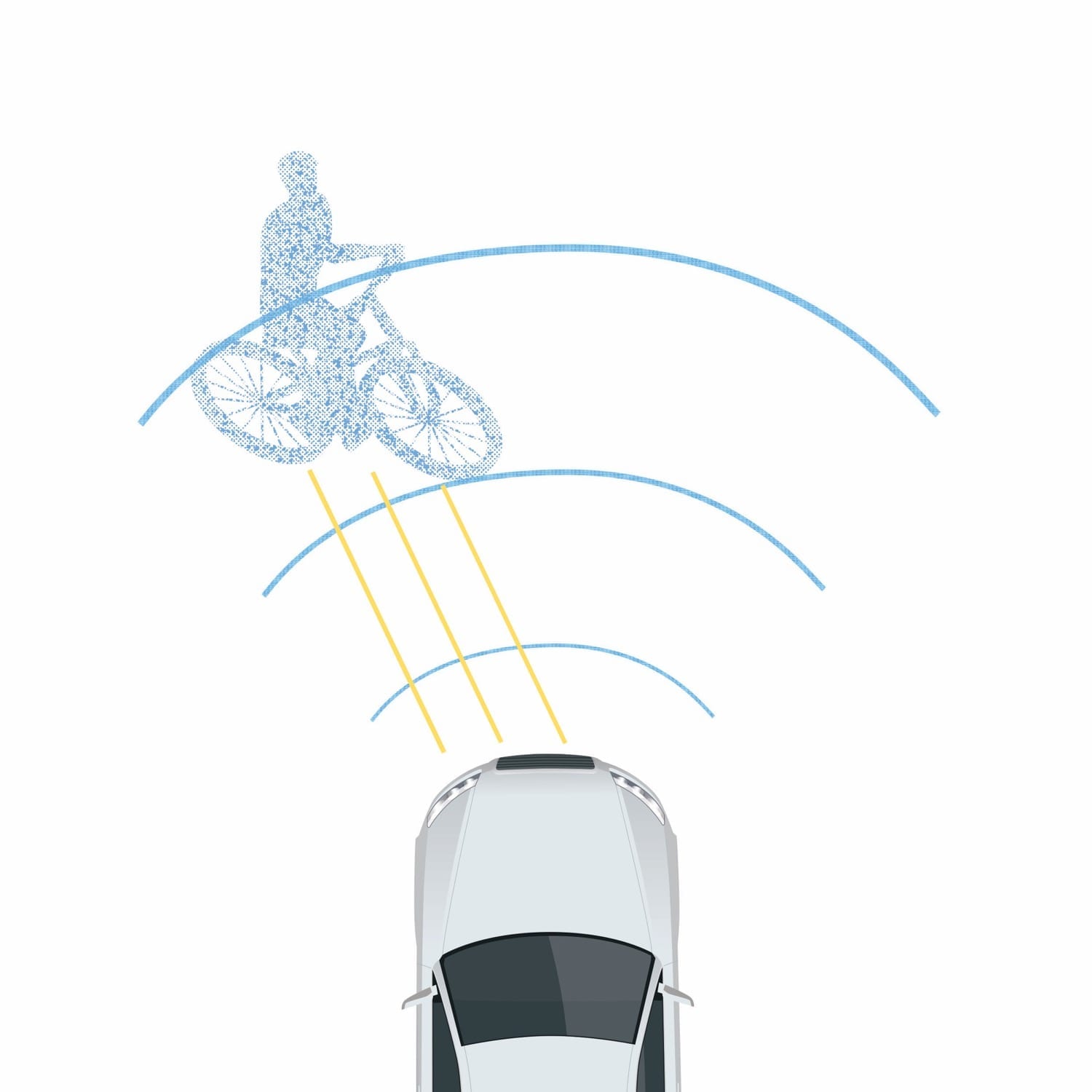
Laser emits light pulses and detects the light reflected by the objects. The sensor measures the time between the emission and return of the laser pulse and thereby calculates exact distances. LiDARs repeat this process a million time per second and summarize the results in a high-definition 3D point cloud. The distance is then calculated using the velocity of light using the formula shown in the figure below.
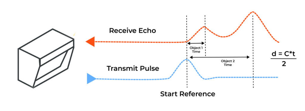
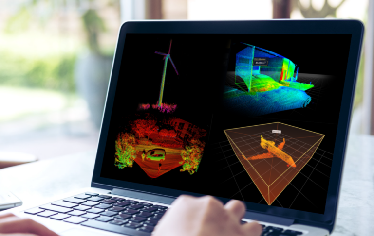
LiDARs repeat this process a million time per second and summarize the results in a high-definition 3D point cloud. Repeat this process millions of times per second, and a precise, real-time 3D map of the environment is generated. This 3D map contains data that is easy to analyze and utilize, for example, for autonomous driving decisions.
Applications of LiDAR sensors
LiDAR sensor has made its way into almost all walks of life and has a wide variety of applications
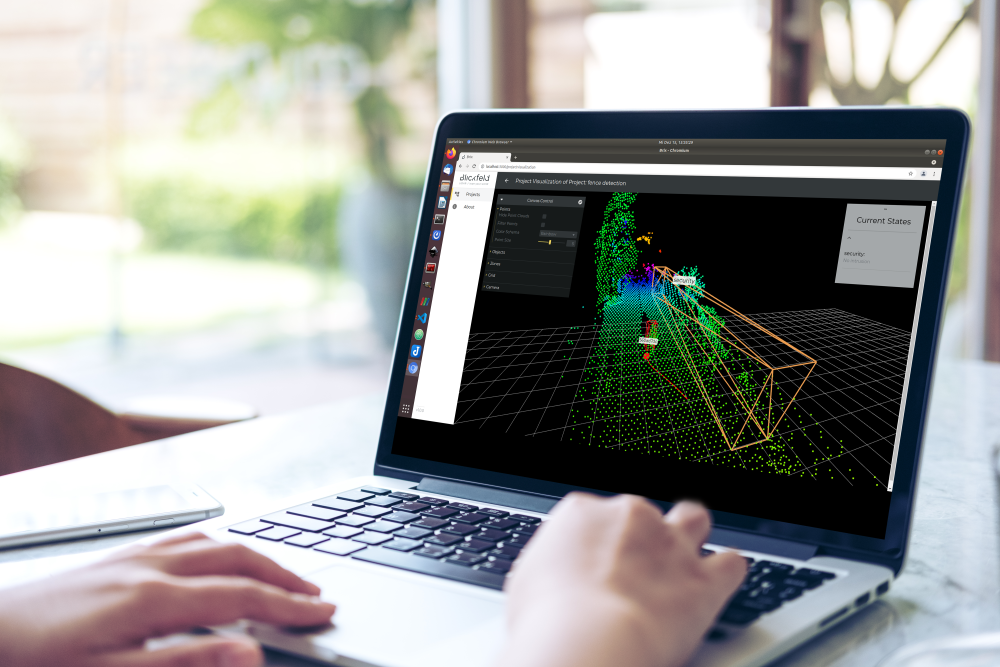
Security: LiDAR-based security systems provide enhanced safety through real-time data processing and high accuracy. Applications range from perimeter protection to facade monitoring and crowd surveillance.
Mapping: LiDAR systems are extensively used for generating digital terrain models (DTMs) and digital elevation models (DEMs) in surveying.
Architecture: LiDAR aids in surveying the built environment, including buildings, roads, and railways, which is vital for smart city applications.
Automotive: LiDAR sensors have regained popularity thanks to automotive applications. LiDAR sensors are an integral part in making autonomous vehicles a reality.
Traffic Management & Infrastructure: LiDAR is used in smart traffic systems for monitoring flow, detecting incidents, and optimizing infrastructure planning.
Industrial Applications: In industries, LiDAR enables tasks such as stockpile management, pallet dimensioning, and bulk material volume measurement.
Real Estate: Laser scanners can be used to measure indoor space and create digital floorplans for virtual tours.
Construction: LiDAR supports building projects through 3D modeling, digital twins for BIM applications, and restoration efforts like Notre Dame’s reconstruction.
Space Travel: LiDAR even has extra-terrestrial applications. NASA and other SpaceX have used LiDARs to assist in the landing and operations of rockets and extra-terrestrial vehicle.
Types of LiDAR
LiDAR sensors can be categorized into different types based on their platforms, underlying technologies, and modus operandi. The diagram below illustrates the main categories with respect to platforms.
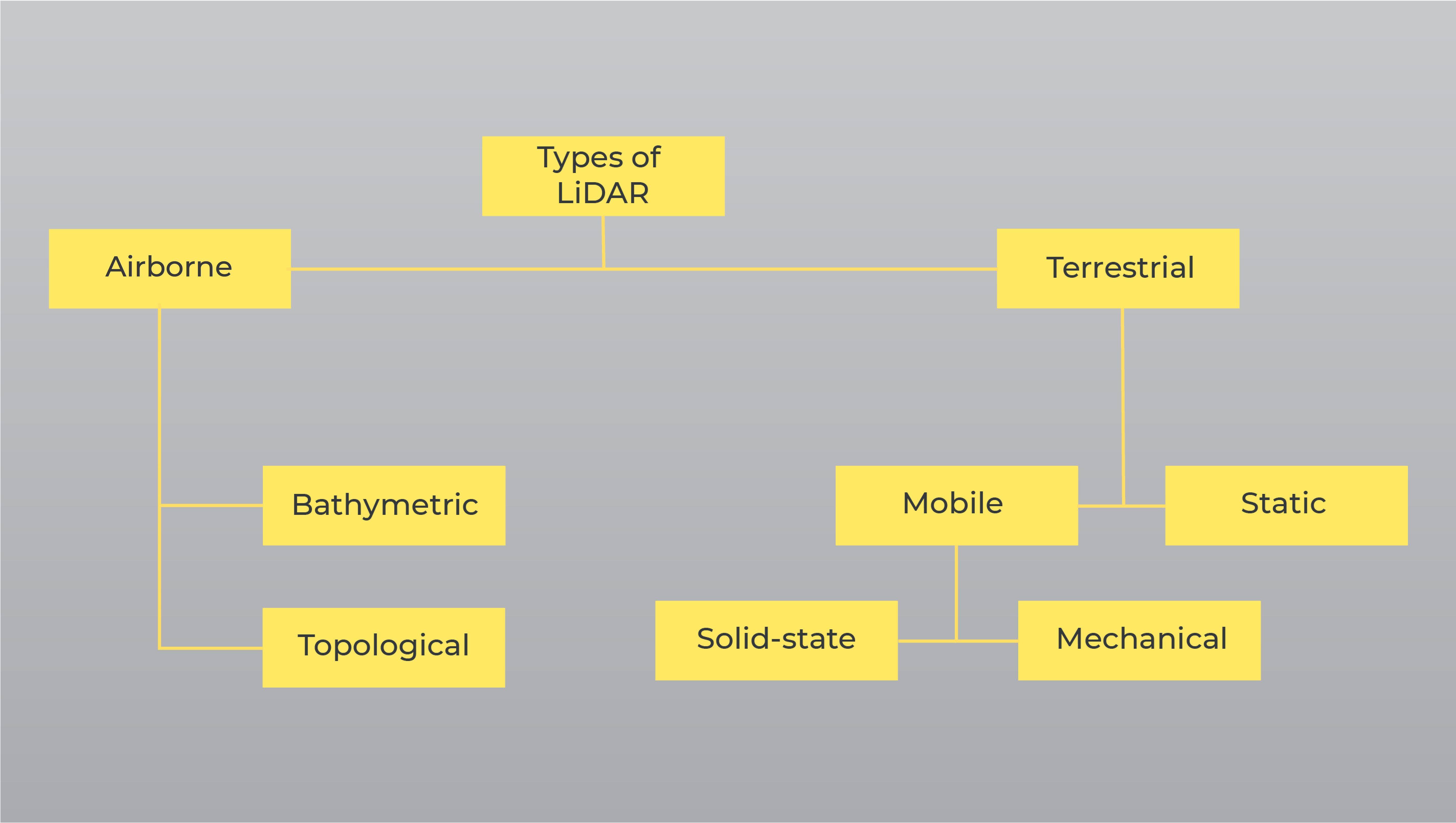
On a high level, LiDAR systems can be divided into two types — Airborne and Terrestrial.
Airborne LiDAR
These were the first LiDAR systems, developed in the 1960s, predominantly for aeronautics and aerospace applications. Airborne LiDARsare usually installed on planes, helicopters, or sometimes even satellites to collect data. LiDAR sends out pulsed light waves towards the ground surface, which returns to the sensor after hitting the object. It gives an exact distance measurement and crucial information on the characteristics of the surface. Naturally, these LiDARs require very high-power emitters to cover such long distances, making them highly complicated and expensive technologies.
Airborne LiDARs can be further divided into two main categories: Topological LiDARs, used for monitoring and mapping topography of a region, and Bathymetric LiDARs, used for measuring the depth of water bodies. Read about the complete evolution of the LiDAR technology here.
Terrestrial LiDAR
In comparison, terrestrial LiDARs operate from the ground level and can scan objects in several directions using mirrors instead of just scanning down. This allows them to scan and reach areas inaccessible to airborne LiDARs.
Terrestrial LiDARs can collect data points with high precision and density, which allows very accurate identification of objects. These dense point clouds are then utilized to identify vehicles, conduct highway and rail surveys, or create 3D city models, to name a few examples.
Terrestrial LiDAR systems again have two types — Static LiDAR and Mobile LiDAR.
Static LiDAR
Static LiDAR collects point clouds from a static location. They can scan in every direction, including upwards. The sensor can be transported to different locations after completing one scan, so the static system — although fixed during scans — is fully portable. Static LiDARs are generally used in mining, surveying, and archaeology applications.
Mobile LiDAR
Mobile LiDAR is leading the way for modern mapping and autonomous driving solutions and incorporates top of the line LiDAR technology to collect quality data points. The method can be employed to acquire millions of 3D design points per minute. The mobile laser can offer a data density of up to 150 points per square foot, making it the fastest way to acquire coordinates compared to all other LiDAR methods.
Mechanical vs Solid-state LiDAR Sensor
Within the mobile LiDARs, there are yet two more types, namely mechanical or rotating LiDARs and solid-state LiDARs.
The rotating or mechanical LiDARs rely on gears and motors to mechanically steer the laser diodes. Although this allows them to offer a 360-degree view of the surroundings and therefore have made them popular in R&D and Autonomous Driving system prototyping, the moving mechanical components are prone to technical failures. They are also more sensitive to vibrations, and expensive (i.e., several-to-tens of thousands of dollars) due to their intricate design, set-up, large dimensions, and manual construction. This makes them not very cost-effective, even when produced in large quantities.
In comparison, MEMS-based LiDAR systems are based on semiconductor technology and therefore are built without motorized mechanical scanning. This makes the entire systems less complicated, more compact, and longer-lasting. They are also less expensive and can be produced reliably, providing a path to high-volume manufacturing and commercial viability. Therefore, the solid-state LiDAR systems act as a breakthrough for many applications, especially the next level of autonomous driving.
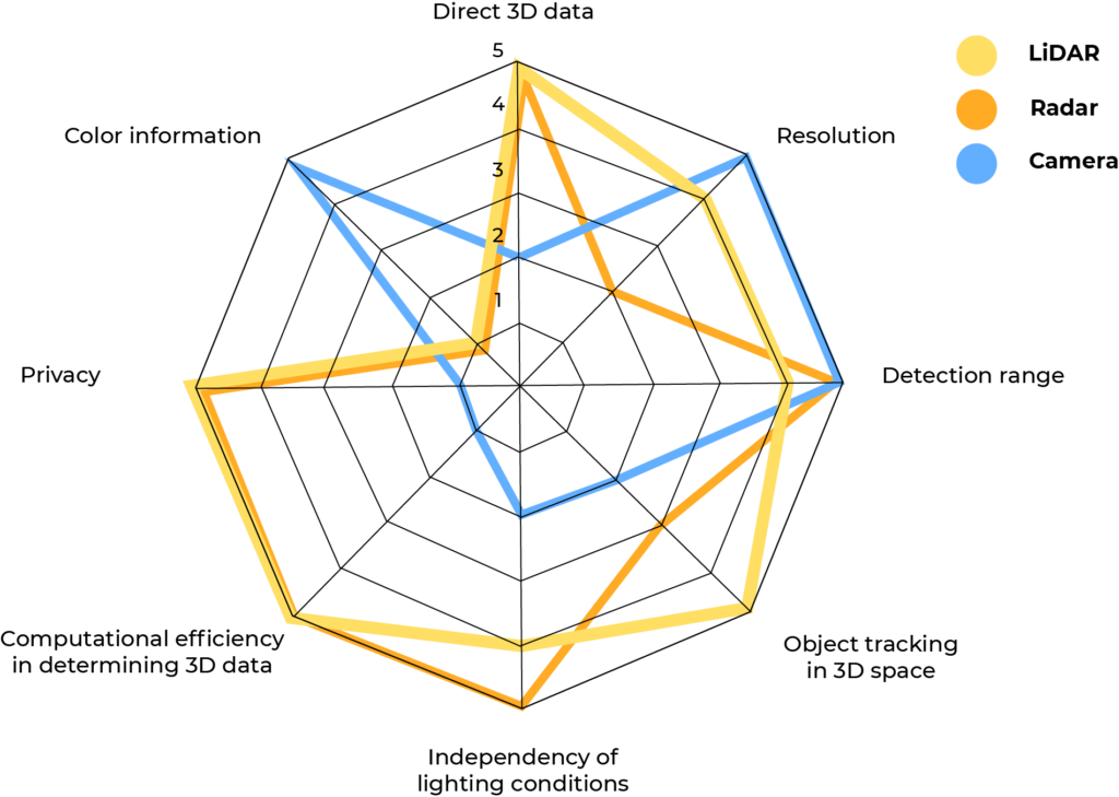
What is the difference between LiDAR Sensors and Other Sensing Technologies?
LiDAR sensors have already phased out several other technologies and sensors, such as Radars or infra-red in many applications, as they were not precise enough in their detection and data encapsulation. For many challenges, such as scanning between trees, LiDAR proves to be a valuable technology as it offers a fast, precise, and direct method of 3D mapping while producing accurate and easy-to-analyze data.
Also in mobility applications, where high precision and reliability is required, the LiDAR technology is gaining popularity, quickly.
These features make LiDAR stand out from most of the alternatives, e.g., photogrammetric techniques that faced difficulties in interpreting ground elevations. Modern LiDARs are also mostly independent of environmental factors, and can work 24/7, giving them a significant edge on sensors like cameras, which are nearly useless in the dark or rain.
LiDAR is capable of providing high-resolution 3D vision by generating millions of data points in real-time. This creates a precise map of the ever-changing surroundings that allow the objects to be recognized and categorized. For instance, a car can easily be distinguished from a cyclist, which is not possible using just radars or ultra-sonic sensors.
LiDAR’s robust performance, an extended range of up to 200 meters, and distance accuracy of a few centimeters allows it to detect objects quickly. And thanks to the advent and adoption of solid-state technology, the cost of these high-resolution 3D sensors has also been considerably reduced, making them a perfect fit for a wide range of technologies.
Here is a figure showing some LiDAR sensor parameters in comparison with other sensors such as Radars and Cameras.
Benefits of LiDAR
- Resolution & Accuracy: LiDAR generates instantaneous, massive amounts of measurements, and can be accurate to a millimeter.
- 3D Mapping: LiDAR data can be easily converted into 3D maps to interpret the environment.
- Low Light Performance: LiDAR is unaffected by ambient light variations, and performs well in low light conditions.
- Speed: LiDAR data are direct distance measurements that don’t need to be deciphered or interpreted– thus enabling faster performance and reducing processing requirement.
- Anonymous detection: LiDAR can accurately detect the type of objects, but it cannot detect faces or identities due to the very nature of the point-cloud, making it perfect for compliance with privacy requirements when used in public applications.
LiDAR: The future of sensing
LiDAR’s reliability and precision make it indispensable across industries. Its role in sensor fusion—combining cameras, radar, and ultrasonic sensors—ensures its continued prominence in emerging technologies like autonomous driving and smart cities.
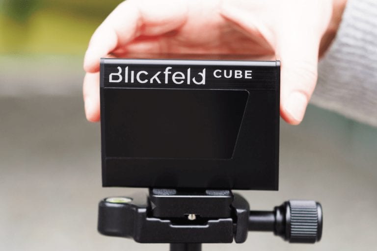
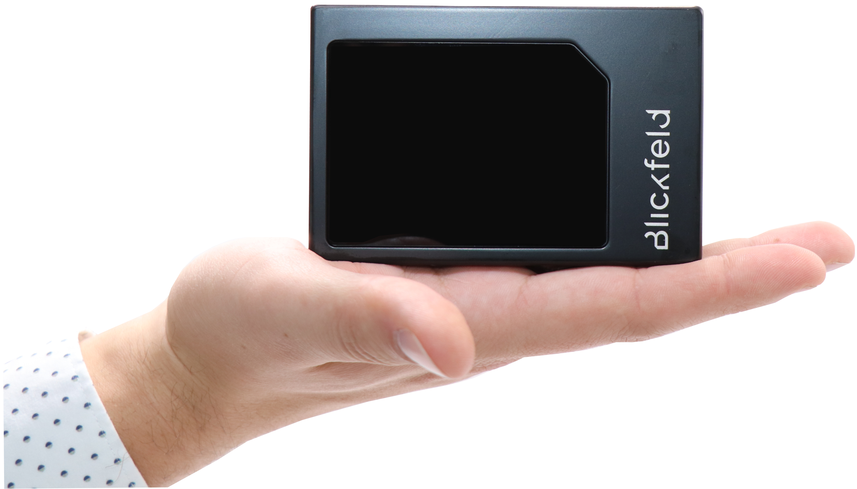
The adoption of MEMS-based LiDAR sensors, such as those offered by Blickfeld, signifies a breakthrough, paving the way for widespread, cost-effective use.