
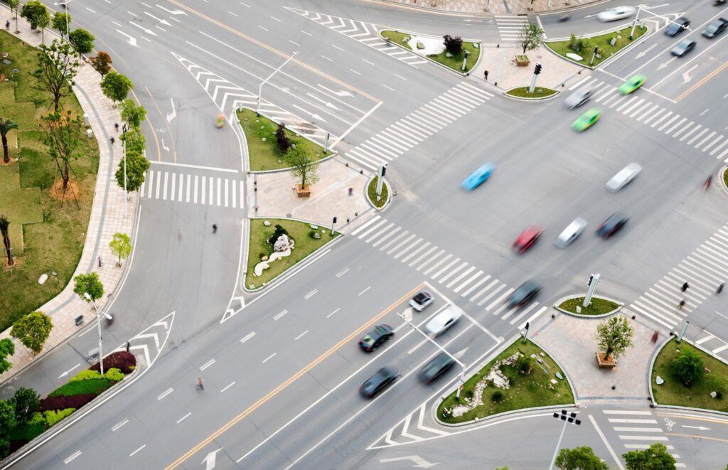
Cities are facing a growing congestion problem. Increasing vehicle registrations mean that more and more cars are using road networks that were not originally designed for such traffic volumes. To manage traffic flows efficiently and avoid congestion, municipalities are challenged to use existing infrastructure more intelligently rather than expanding it at great expense.
A key lever in this context is smart traffic signal control. By adjusting red and green phases based on real-time traffic data, traffic flows can be actively managed. At the same time, public transport and emergency vehicles can be prioritized, improving both the performance and reliability of the overall system.
However, the effectiveness of such solutions depends largely on the quality of the underlying traffic detection. This is precisely where it becomes evident that traditional detection systems, which have reliably served for decades, are increasingly reaching their technical and economic limits.
Inductive Loops – The Established Standard
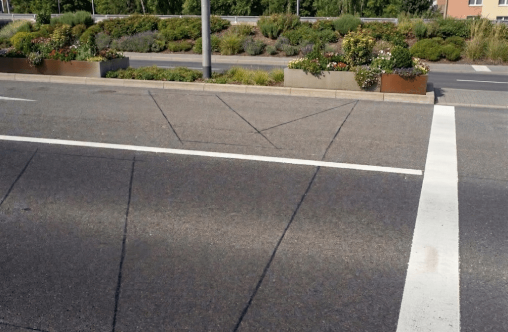
Inductive loops have been the backbone of traffic detection at signalized intersections for decades. Embedded in the road surface, these wire loops detect vehicles through changes in the electromagnetic field. The technology is robust, standardized, widely used, and therefore relatively inexpensive to acquire.
At the same time, it comes with structural disadvantages: every installation or repair requires intervention in the asphalt, along with road closures, construction logistics, and follow-up costs. In addition, inductive loops only provide point-based information: a vehicle is either present or not. Differentiation by vehicle type, detection of bicycles or pedestrians, and area-wide monitoring of traffic are only possible to a limited extent, if at all.
LiDAR for Traffic Detection as an Innovative Alternative
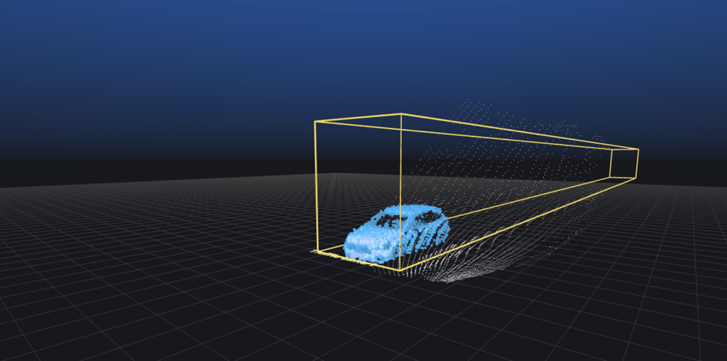
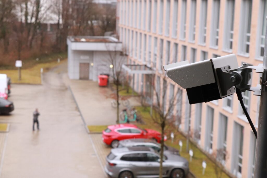
LiDAR sensors (Light Detection and Ranging) operate on a fundamentally different principle. They emit laser pulses and calculate precise three-dimensional point clouds of their surroundings based on the time of flight of the reflected signals.
Compared to camera-based systems and other sensor technologies, LiDAR offers decisive advantages: unlike cameras, it does not rely on image-based analysis and is independent of lighting conditions. Since it captures only distance information and collects no personal data, LiDAR is also a strong choice from a data protection perspective. At the same time, it provides significantly more spatial information than radar.
Originally known from surveying and autonomous driving, LiDAR has evolved in recent years into a mature key technology for various applications, including smart city solutions.
Integration of LiDAR into Existing Infrastructure
In smart city applications, one of LiDAR’s key advantages lies in its ability to integrate seamlessly into existing infrastructure. Sensors can be mounted on existing structures such as traffic signal poles, streetlights, or building facades. Power supply and data connectivity can often be sourced from the existing infrastructure.
This eliminates the need for extensive construction work entirely. Instead of cutting into asphalt and disrupting traffic, the road remains untouched: no construction sites, no closures, no interference with traffic flow. Intersections can be retrofitted, scaled, or adjusted during ongoing operation. Traffic detection effectively moves from the road surface to an elevated perspective, opening up new degrees of freedom in planning and operation.
LiDAR vs. Inductive Loops: A Functional Comparison
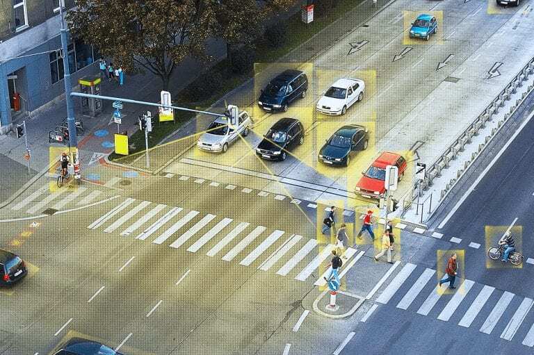
While inductive loops provide individual detection points, LiDAR sensors capture the entire intersection as a three-dimensional space. Vehicles, bicycles, pedestrians, and even groups of waiting people can be detected and classified simultaneously. This results in a complete, continuously updated representation of traffic conditions that is not limited to individual lanes or measurement points.
Beyond mere presence detection, speeds, movement directions, and queue lengths can be derived. More complex situations such as turning maneuvers, lane changes, or mixed traffic interactions can also be captured and analyzed. This level of data quality enables not only the detection but also the understanding and prediction of traffic flows. It forms the basis for adaptive, context-dependent control logic in smart traffic signal systems.
Added Value for Smart Traffic Signal Control
With comprehensive and three-dimensional LiDAR traffic detection, a continuous representation of the entire traffic situation becomes available. This allows signal programs not only to react to current conditions but also to be optimized proactively.
Green phases can be dynamically controlled based on real traffic flows, taking into account approach speeds, vehicle densities, and emerging queues. For example, congestion can be detected early and mitigated before it affects neighboring intersections. At the same time, coordination between multiple traffic signals along a corridor becomes more precise, as reliable real-time data replaces static assumptions.
Another major advantage lies in the targeted prioritization of specific road users. Public transport vehicles can be detected early and prioritized, typically via radio-based communication with the signal control system. LiDAR-based detection complements these systems by precisely capturing actual approach movements within the intersection area and integrating them into control logic. Non-motorized traffic also benefits: pedestrian and cyclist crossing demands are no longer captured solely via push buttons or indirect logic but are derived directly from real behavior in the traffic space.
Overall, this higher data quality leads to more stable traffic flows, reduced waiting times, and measurable relief for infrastructure. At the same time, emissions and noise pollution decrease due to reduced stop-and-go traffic – an effect particularly relevant in densely built urban environments.
Economic and Operational Benefits
From an economic perspective, the use of LiDAR shifts the focus from pure investment costs to a holistic lifecycle view. While the initial costs for sensors are often higher than those of traditional inductive loops, the main expenses in conventional systems arise not from procurement but from operation. LiDAR offers clear advantages, particularly in installation and maintenance.
Another economic lever lies in the high flexibility of software-based systems. Changes in traffic management or new prioritization strategies can often be implemented through software configuration without requiring physical modifications to infrastructure. This reduces not only direct costs but also planning and implementation time.
Over the entire lifecycle, this often results in advantages in total cost of ownership. Especially at highly congested intersections, complex junctions, or in areas with frequently changing traffic demands, the use of LiDAR can deliver significant economic benefits.
Technical and Regulatory Aspects
Modern LiDAR systems are increasingly designed as decentralized, intelligent sensor units. A large portion of data processing takes place directly on the sensor (edge processing), where raw data is analyzed in real time and converted into abstracted information such as object classes. This reduces transmitted data volumes while increasing system responsiveness.
Standardized interfaces play a key role in integrating LiDAR into existing traffic infrastructures. Many LiDAR systems can provide detection data in common formats, allowing integration into existing controllers and traffic management platforms. As a result, existing systems do not need to be replaced but can be gradually extended.
In addition, regulatory requirements, municipal guidelines, and safety standards can be met without fundamentally altering the overall architecture. LiDAR integrates as a compatible extension into existing system landscapes, enabling an evolutionary development of traffic control rather than a disruptive overhaul.
From Point Detection to Intelligent Traffic Surfaces
The shift from inductive loops to LiDAR sensors represents more than just a change in technology. It marks a paradigm shift: from point-based presence detection to holistic, data-driven capture of urban traffic realities.
LiDAR enables cities to use existing infrastructure more intelligently without physically rebuilding it. Traffic signal control becomes a learning system, and the intersection evolves into a digital representation of real-world traffic.
For smart cities, LiDAR is not just an alternative to inductive loops, it is a key building block for the mobility of tomorrow.