
Last updated on 15-Oct-2021
Traffic Congestion: A Modern-Day Nuisance
If you have ever driven along the Mittlerer Ring in Munich during the rush hour, you will be aware of the enormous problem facing urban spaces throughout the world: traffic jams as far as the eye can see. On average, Germans were stuck in traffic for 46 hours per year, and in Munich, for as long as 87 hours, in 2019. That is more than 3 and a half days per person every year!
For individuals, these lost hours are annoying and impair their quality of life. For the state, though, these figures mean considerable economic effects. Traffic jams cost several billion euros per year because employees are stuck in the tie-ups instead of being productive, and goods are on the road instead of on the shelf. In addition, there is an elevated level of environmental pollution due to increased fuel consumption and thus increased CO2 emissions.
What Causes Traffic Jams?
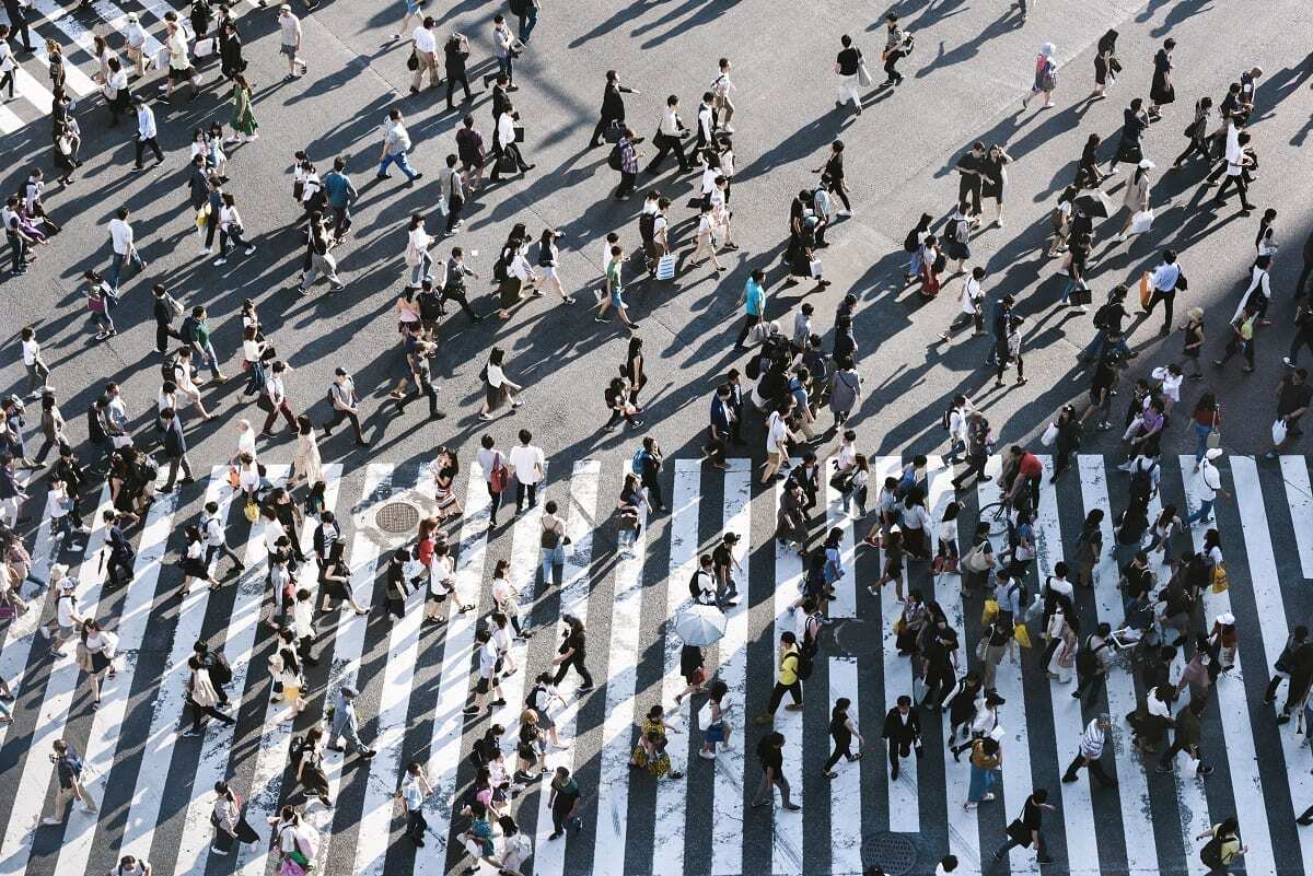
How do traffic jams develop? They are a distributed problem caused by multiple factors such as road works, accidents, traffic overload on the same route, and large numbers of pedestrians holding up the vehicles. While these factors can be mitigated to some extent, one factor that is very difficult to predict and manage is the behavior of drivers on the road.
All road users drive their vehicles in a way that is optimized for themselves. For example, they may catch up with the car in front or change lanes – whatever appears to them to be the best way to get to their destination faster. Since the individual road users cannot see how they influence the traffic around them, they cannot take that factor into account. Drivers themselves are not equipped for traffic prediction hence cannot accurately predict or calculate that traffic jams can be triggered even three kilometers behind the vehicle that is stopping.
Therefore, the behavior of individuals must be counterbalanced and taken into account during traffic planning to optimize the flow of traffic. The solution is to regulate traffic in a pre-emptive and distributed manner, i.e., with anticipation and going beyond the individual road user. This requires a complete overview of the traffic situation.
This challenge can be met with a smart vehicle operating in a smart environment, which leads us to the concepts of smart infrastructure.
What is Smart Infrastructure?
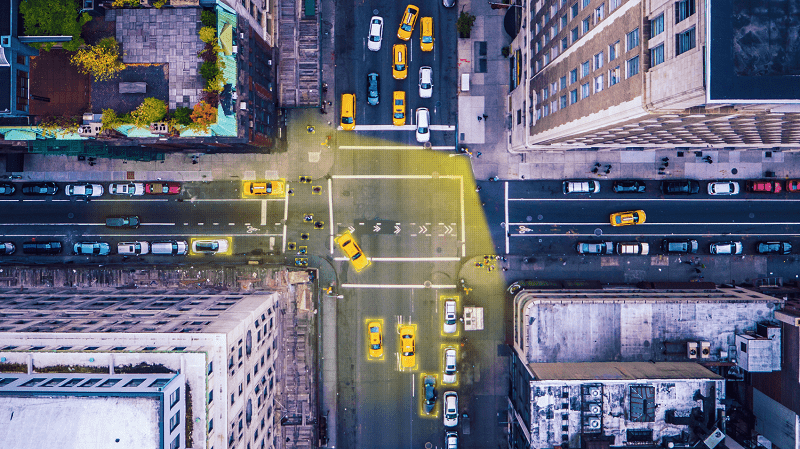
Smart infrastructure describes the concept of equipping the existing road infrastructure with technology, such as GPS, cameras, and sensors, to collect data through constant traffic monitoring. They are systems that make decisions regarding urban challenges easier through data and feedback collected through monitoring. This data can then be employed to dynamically adapt the traffic flow and schedules.
Gaining a complete overview with GPS, cameras and sensors
Several technologies can be used, usually in combination, to enable smart infrastructure and work towards finding solutions for traffic congestion—some being more apt than others.
GPS:
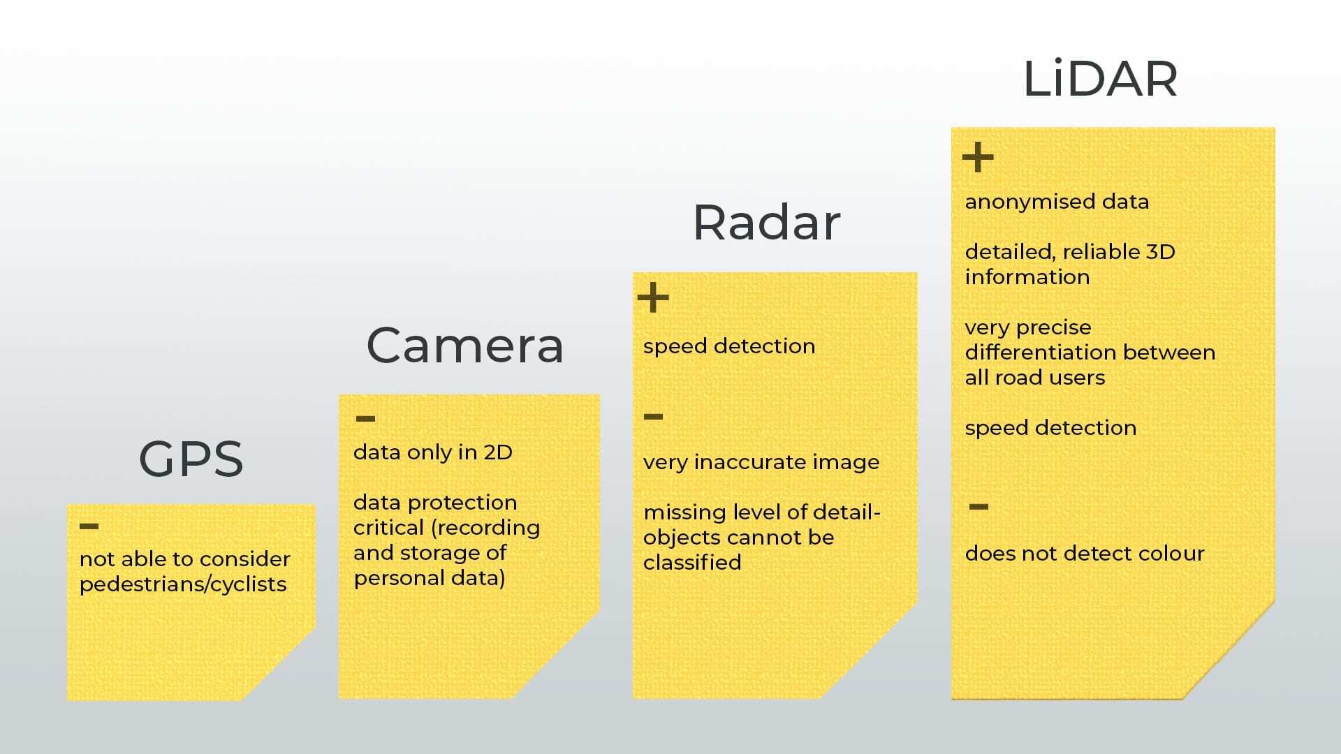
GPS provides valuable data by tracking the movements of road users. This technology can therefore be used to report traffic jams quite reliably. The ability to take pedestrians and cyclists into account, however, exceeds the capabilities of GPS.
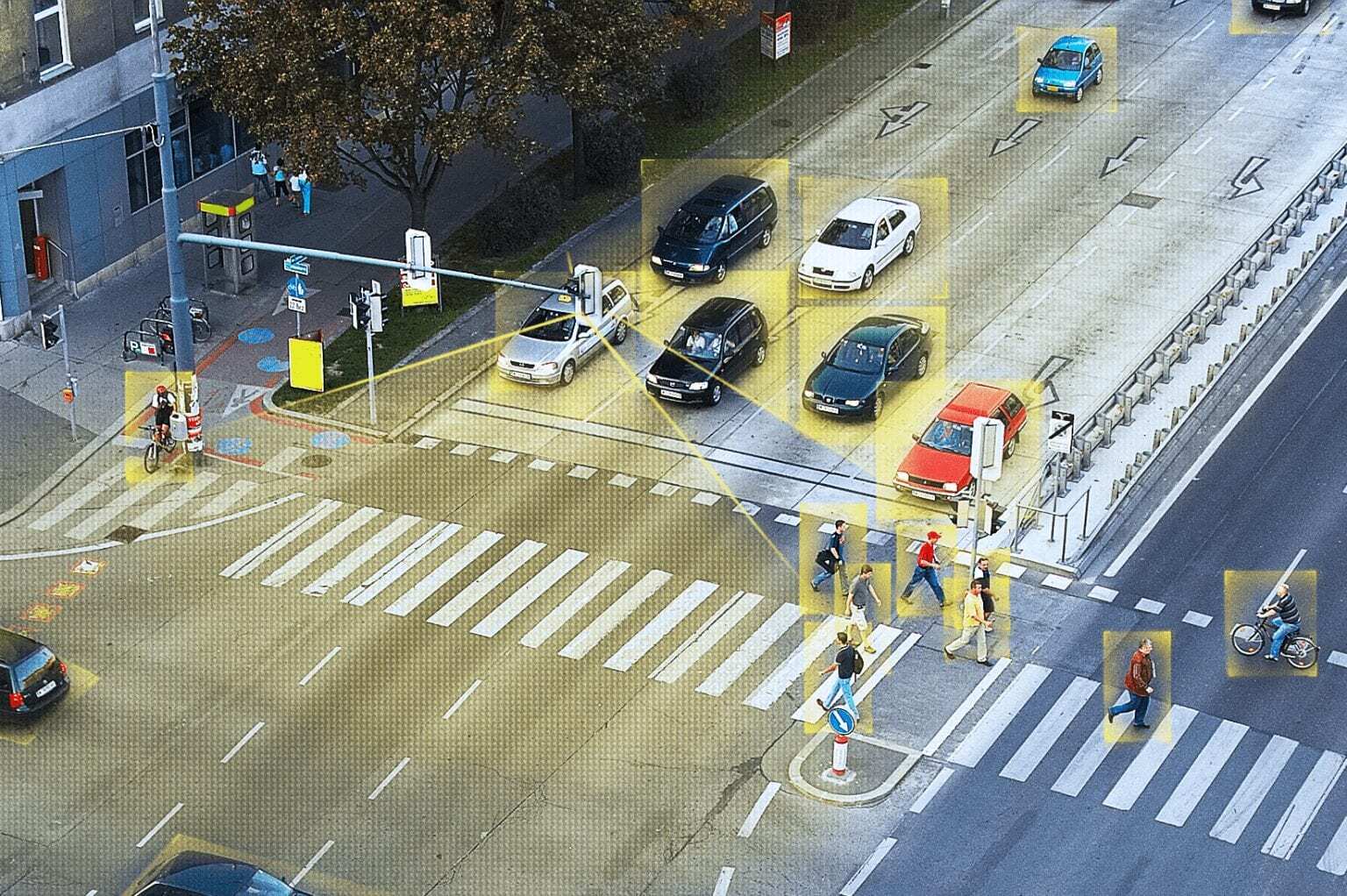
Instead of collecting information with the help of road users, as in the case of GPS, sensors and cameras can be integrated into the infrastructure to monitor the traffic situation. This requires that the devices be installed in traffic lights, street lamps, or traffic signs so that they can collect information about their surroundings from there.
Cameras:
Cameras, for example, are able to record color images, but they cannot provide the same quality when used in darkness or in bad weather conditions. Additionally, they only capture the data in 2D, whereas 3D data is needed to reliably detect objects and determine distances. They are also not the best option in regard to data privacy.
Radar:
Radar is mainly used for speed monitoring but could also be used for traffic surveillance. However, Radar only provides a very crude picture due to the lack of resolution. Although the technology can identify objects, it is not able to classify them. For instance, Radar data cannot reliably distinguish between pedestrians and cyclists.
You can read a more detailed blog on the comparisons of different types of sensors here.
LiDAR: Capturing Road Users Precisely and Anonymously
Laser-based LiDAR technology provides detailed and reliable 3D information that makes it easy to distinguish between different road users. And while it is possible to classify objects using the 3D point cloud into pedestrians, cars, cyclists, etc., individual identification is not possible, therefore protecting the privacy of road users.
In addition, LiDAR sensors can reliably collect information even in difficult weather and lighting conditions. Darkness, dust, or fog do not bother the technology. Moreover, using the position and object classification and information, the sensors also record speeds, which can help analyze traffic flow or the causes of traffic jams.
LiDAR can also help construct high-definition city maps for traffic prediction and suggests alternate routes. This data can be then used to smartly manage road signals and provide timely traffic prediction, which not only reduces traffic jams but also cuts down smoke emissions from vehicles by a significant amount.
Traffic Information from a Smart Infrastructure Enables Practical Measures
The LiDAR sensors installed in the infrastructure provide information about the real-time traffic situation: Is the traffic flowing or stagnant? Is there an accident or a construction site? Are there many pedestrians at the traffic lights or at the crosswalk?
With this information, the following measures can be taken in real-time and adapted to the traffic in order to optimize the traffic flow:
- Implementation of smart traffic light
- Adaptation of speed limits
- Displaying traffic jam warnings
- Showing redirection recommendations
- Identification and reconstruction of hazardous locations
Cities that Revolve Around People Again
In many cities, the influences of the paradigm of the “car-friendly city” can still be clearly seen today. Urban planning is aligned to the goal of the unhindered traffic flow by car. Even though this model has been subject to strong criticism for several decades now, many traffic concepts in cities are still oriented towards motorized individual transport.
In recent years, there has been an increased demand for this approach to be replaced by people-centric cities with car-free zones and city centers. The needs of residents, commuters, and all other road users must be centremost, which means making mobility as safe and uncomplicated as possible.
Road planning and traffic management must be rethought and should include alternate forms of travel as well cars. This would inculcate measures like making pedestrian crossings safer, reducing turning accidents, offering dedicated tracks for cyclists, creating bus lanes, and so on. This, in combination with sensor-based smart infrastructure, will definitely help us get rid of the scourge of traffic jams.